News

Weather
Posted: Nov 02, 2024 11:17 AMUpdated: Nov 02, 2024 11:21 AM
Severe Storms and Flooding Outlook: Saturday
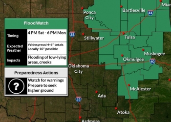
A weather system bringing heavy rainfall and thunderstorms is forecast to move into northeast Oklahoma this evening, sparking concerns over potential flash flooding and isolated severe storms. The rainfall is expected to persist through the night, producing several inches of rain in certain areas and causing a heightened flood risk.
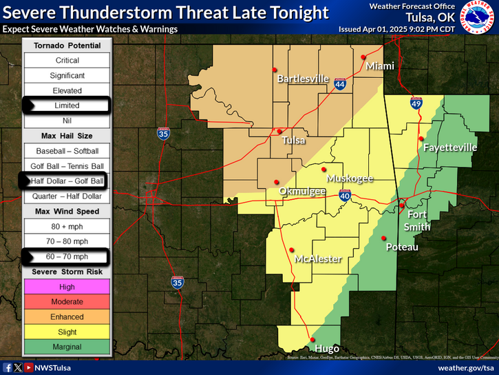
According to the National Weather Service, the heaviest rainfall will concentrate in a narrow band across northeast Oklahoma. With several inches anticipated, flash flooding remains a possibility, particularly in flood-prone regions. The highest risk areas lie west of Highway 75, where isolated severe thunderstorms could bring damaging winds and heavy downpours.
In addition to rainfall, southeast winds are expected to increase overnight, with gusts reaching up to 30 miles per hour. Local storm spotters and emergency management teams have been placed on standby for potential activation, as the storm system may warrant swift response efforts.
Forecast Outlook: Continued Rain and Storms Through Early Week
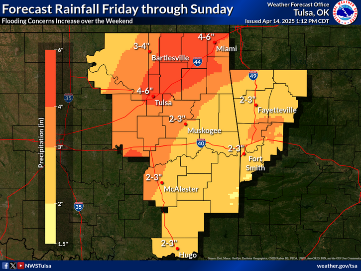
The severe weather threat will continue into Sunday and Monday, when further rounds of showers and thunderstorms are anticipated to expand across eastern Oklahoma and into northwest Arkansas. Meteorologists predict that these storms could deliver an additional 3 to 6 inches of rain to already saturated areas, with isolated totals reaching as high as 10 inches. The risk of severe thunderstorms will peak late Sunday into Monday, increasing concerns over both flooding and storm damage.
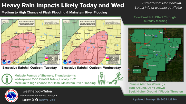
The flood watch currently in effect covers multiple counties across east-central, northeast, and southeast Oklahoma, including Cherokee, Tulsa, Rogers, and Washington counties. Residents in these areas are advised to prepare for potential flooding and monitor forecasts closely, as flood-prone locations like rivers, creeks, and low-lying areas may be at risk.
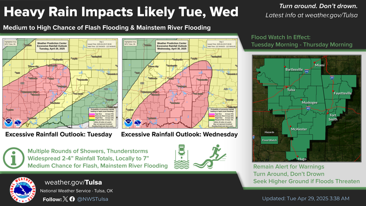
Key Advisories for Affected Residents
- Flood Watch: From Saturday afternoon through Monday afternoon.
- Impacts: Excessive runoff from heavy rainfall could lead to river and stream flooding, along with potential urban flooding in low-lying areas.
- Precautions: Those in flood-prone zones should be prepared to take action if flood warnings are issued.
While Tuesday and Wednesday bring a reprieve from hazardous weather, another storm system is predicted to arrive late next week, potentially bringing further showers and thunderstorms to the region.
For updated information, residents are encouraged to check the National Weather Service’s flood safety resources at weather.gov/safety/flood and remain vigilant for local alerts.
STAY TUNED TO BARTLESVILLE RADIO FOR SEVERE WEATHER UPDATES AND STORM INFORMATION.
WE'RE HERE TO PREPARE YOU--NOT SCARE YOU.
« Back to News


